
What is the new disengagement agreement in eastern Ladakh?
Why In News?
China and India have reached an agreement under which “both sides will cease their forward deployments in a phased, coordinated and verified manner”.
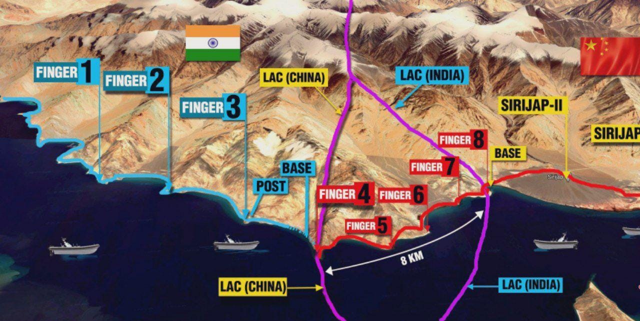
As part of the process, Chinese troops will pull back from Finger 4 to east of Finger 8 on the Pangong north bank – they had come in 8 km west of Finger 8 which India says marks the LAC. Indian troops will be stationed at Dhan Singh Thapa Post near Finger 3. For the time being, the stretch separating them will be a no-patrolling zone.
What does this disengagement process entail?
Both sides will remove the forward deployment in a phased, coordinated and verified manner.
“China will pull its troops on the north bank towards the east of Finger 8. Similarly, India will also position its forces at its permanent base at the Dhan Singh Thapa post near Finger 3. Similar action will be taken by both the parties in the south bank area as well.”
Both sides have also agreed that the area between Finger 3 and Finger 8 will become a no-patrolling zone temporarily, till both sides reach an agreement through military and diplomatic discussions to restore patrolling.
Further, all the construction done by both sides on the north and south banks of the lake since April 2020 will be removed.
India has maintained the three key principles that determine its approach:
- Both sides should strictly respect and observe the LAC;
- Neither side should attempt to alter the status quo unilaterally; and
- All agreements and understandings between the two sides must be fully abided by in their entirety.
To ensure disengagement in friction points along the LAC, it was our view that troops of both sides, who are now in close proximity, should vacate the forward deployments made in 2020 and return to the permanent and accepted bases.”
Background:
The LAC mostly passes on the land, but Pangong Tso is a unique case where it passes through the water as well. The points in the water at which the Indian claim ends and Chinese claim begins are not agreed upon mutually.
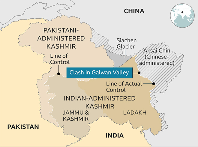
Line of Actual Control
The disputed boundary between India and China, also known as the Line of Actual Control (LAC), is divided into three sectors: western, middle and eastern. The countries disagree on the exact location of the LAC in various areas, so much so that India claims that the LAC is 3,488 km long while the Chinese believe it to be around 2,000 km long.
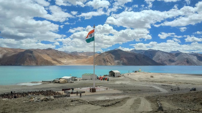
The Pangong Tso Lake
- Pangong Tso Lake in eastern Ladakh has often been in the news, most famously during the Doklam standoff, when a video of the scuffle between Indian and Chinese soldiers.
- In the Ladakhi language, Pangong means extensive concavity, and Tso is a lake in Tibetan.
- Pangong Tso is a long narrow, deep, endorheic (landlocked) lake situated at a height of more than 14,000 ft in the Ladakh Himalayas.
- The western end of Tso lies 54 km to the southeast of Leh. The 135 km-long lake sprawls over 604 sq km in the shape of a boomerang and is 6 km wide at its broadest point.
- The brackish water lake freezes over in winter and becomes ideal for ice skating and polo.
- The legendary 19th century Dogra general Zorawar Singh is said to have trained his soldiers and horses on the frozen Pangong lake before invading Tibet.
Tactical significance of the lake
- By itself, the lake does not have major tactical significance.
- But it lies in the path of the Chushul approach, one of the main approaches that China can use for an offensive into Indian Territory.
- Indian assessments show that a major Chinese offensive if it comes, will flow across both the north and south of the lake.
- During the 1962 war, this was where China launched its main offensive — the Indian Army fought heroically at Rezang La, the mountain pass on the southeastern approach to Chushul valley, where the Ahir Company of 13 Kumaon led by Maj. Shaitan Singh made its last stand.
- Not far away, to the north of the lake, is the Army’s Dhan Singh Thapa post, named after Major Dhan Singh Thapa who was awarded the country’s highest gallantry award, the Param Vir Chakra.
- Major Thapa and his platoon were manning Sirijap-1 outpost which was essential for the defence of Chushul airfield.
Fingers in the lake
- The barren mountains on the lake’s northern bank, called the Chang Chenmo, jut forward in major spurs, which the Army calls “fingers”.
- India claims that the LAC is coterminous with Finger 8, but it physically controls area only up to Finger 4.
- Chinese border posts are at Finger 8, while it believes that the LAC passes through Finger 2.
- Around six years ago, the Chinese had attempted a permanent construction at Finger 4 which was demolished after Indians strongly objected to it.
- Chinese use light vehicles on the road to patrol up to Finger 2, which has a turning point for their vehicles.
- If they are confronted and stopped by an Indian patrol in between, asking them to return, it leads to confusion, as the vehicles can’t turn back.
- The Chinese have now stopped the Indian soldiers moving beyond Finger 2. This is an eyeball-to-eyeball situation which is still developing.